
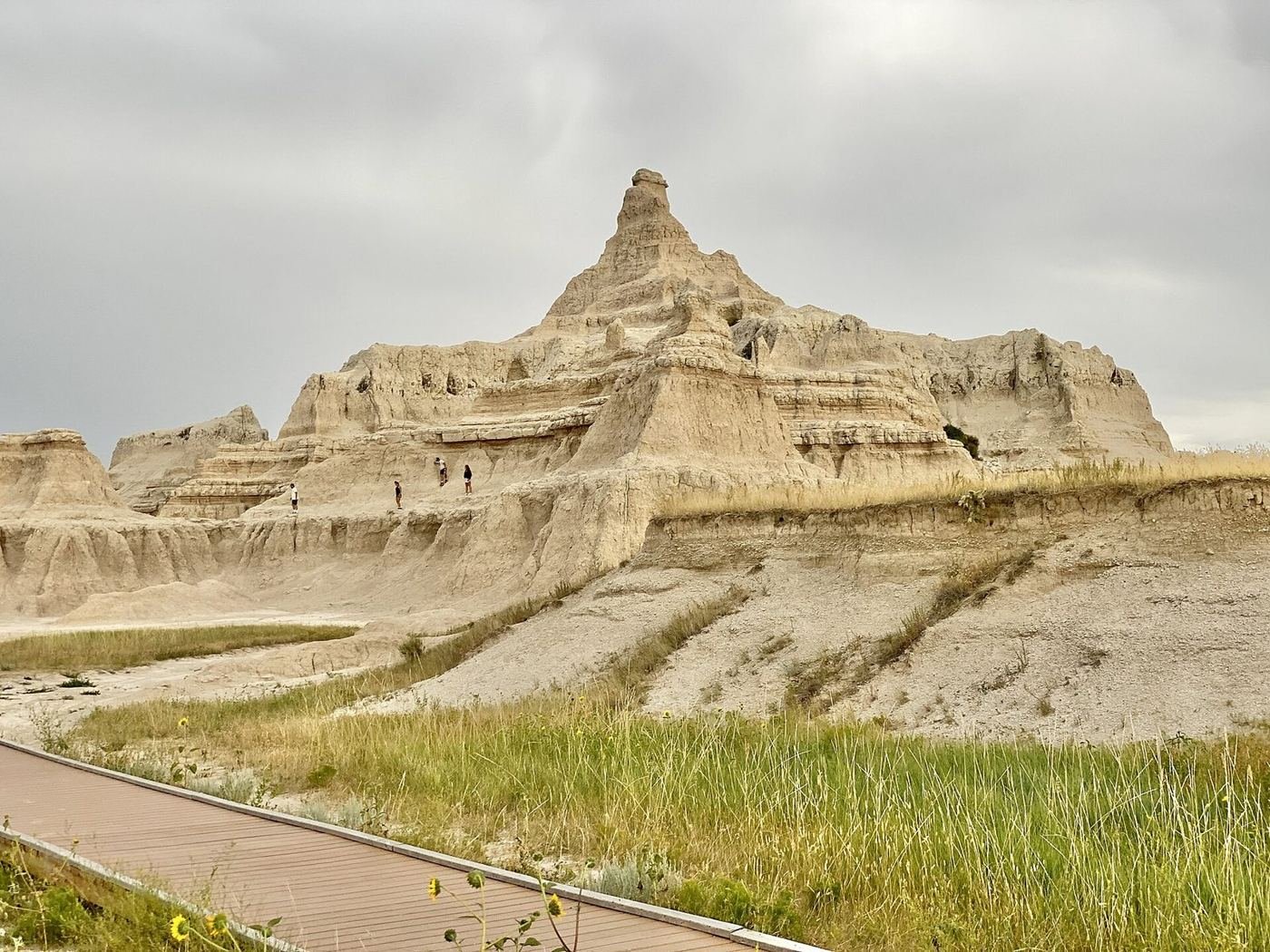
Badlands National Park is a place where the landscape looks like a different planet and the drive from the interstate takes you there in minutes. Layered spires and ridges of striped sandstone rise out of a mixed-grass prairie, and the whole thing is so compact that a 31-mile loop road covers almost every highlight. It's also one of the easiest parks to combine with a bigger Black Hills trip, which is part of why it's so often a one-day stop.
I'd treat it as a day and a half rather than a day, though. The light on the formations is at its best in the first and last two hours of the day, and the wildlife — bison, bighorn sheep, and a huge prairie dog town — is out on the quieter western half of the park, away from the loop road crowds.
If You Only Have 1 Day: The Badlands Loop Road
If I only had one day, I'd drive the Badlands Loop Road (Highway 240) from east to west, stopping at the overlooks and doing three short walks from the same parking area. That gets you almost everything iconic about the park in about five hours.
Notch Trail — the ladder and the window
The park's most famous short walk: a trail up a canyon, up a log ladder, and along a ledge to a notch that opens onto a huge view of the White River Valley. It's exposed in places and not great for anyone with a fear of heights, and it's treacherous in or after heavy rain. If the ladder worries you, the base of it makes a fine turnaround point.
Door Trail and Window Trail — the quick boardwalk pair
Two short walks from the same lot as the Notch Trail. The Window is a 5-minute boardwalk to a view through an eroded gap, and the Door runs a bit farther onto the formations. They're both easy, and the best way to see the badlands up close without a hike.
Fossil Exhibit Trail — the quick fossil stop
A short boardwalk with replica fossils of some of the animals that lived here, such as ancient rhinos and saber-toothed cats. It's a quick stop that gives the geology a story, and it's good for kids.
For sunset, I'd head to Pinnacles Overlook at the western end of the loop, where the light turns the formations gold and the sun sets over the prairie.
Got a 2nd Day? Castle Trail and the Quiet Side
With a second day I'd walk the longest trail in the park and then spend the rest of it on the western side, where there's less traffic and more wildlife.
Castle Trail — the long walk across the prairie
A mostly flat, exposed trail that crosses the prairie between the Door and Window lot and the Fossil Exhibit Trail. It's less dramatic than the short walks, but it's the best way to feel how big the landscape is. It can be very hot, so I'd start at sunrise and carry plenty of water. Rain turns the clay into impassable mud.
Medicine Root Loop — the shorter option
A loop that links the Castle Trail with the Medicine Root Trail for a shorter version of the same experience. It's a good choice if you want a taste of the prairie without a full day.
Cliff Shelf Nature Trail — the bighorn loop
A short boardwalk loop through a juniper-covered slump block above the visitor center, where bighorn sheep are often seen. A good early-morning stop.
The Full 3 Days — Sage Creek Rim Road and the Prairie
If I had a third day, I'd spend it on the western side of the park, on the Sage Creek Rim Road, which is mostly gravel and passes through the Sage Creek Wilderness. It's where most of the park's wildlife lives.
Sage Creek Rim Road — the wildlife drive
A 23-mile mostly gravel road that runs along the northern rim of the wilderness, with big views, and a good chance of bison, pronghorn, and bighorn sheep. It's passable for most cars in dry weather, but I'd skip it after rain.
Roberts Prairie Dog Town — the easy wildlife stop
A huge colony of black-tailed prairie dogs next to the Sage Creek road, with a safe pullout and plenty of entertaining behavior. A good stop with kids.
Saddle Pass Trail — the short, steep scramble
A short, very steep trail up a gully from the loop road to the prairie above, and the start of the Castle Trail. It's a fun, quick scramble, but it's loose and I'd go down it carefully.
Where I'd Eat
Dining inside the park is limited to one lodge restaurant, so I'd plan on the nearby town of Wall for more options, and pack a lunch for the loop road.
Cedar Pass Lodge Restaurant
The only restaurant inside the park, known for its Indian tacos and burgers. A convenient lunch or dinner stop near the visitor center.
View on Google Maps ↗Wall Drug Store Restaurant
The famous roadside attraction in Wall, with homemade donuts, hot beef sandwiches, and buffalo burgers. It's touristy, but it's a South Dakota institution.
View on Google Maps ↗Wagon Wheel Bar & Grill
A no-frills local bar in Wall with steaks and burgers, and a good alternative to the tourist spots.
View on Google Maps ↗Red Rock Restaurant
A longtime Wall restaurant with a broad menu and family-friendly atmosphere. A solid, straightforward dinner.
View on Google Maps ↗Dairy Queen in Wall
A quick stop for ice cream and a burger after a hot day on the trail.
View on Google Maps ↗Where I'd Stay
There's only one lodge inside the park, and it's small, so I'd book early or plan on Wall.
Cedar Pass Lodge
The only lodging inside the park, with 23 small cabins near the visitor center. It's seasonal, typically open from spring through October, and books up fast.
View on Google Maps ↗Cedar Pass Campground
A campground near the visitor center, open from spring through October. A good option for a short stay.
View on Google Maps ↗Wall, SD
The closest town with motels, just a short drive from the Pinnacles entrance. The most practical base for a one- or two-day visit.
View on Google Maps ↗Build This Exact Trip, Free
I built ParkPlan because I wanted this kind of plan for every park, not just the one I happened to write up. It turns this into a real day-by-day itinerary with your own dates, travelers, and budget.
Start My Badlands Trip → Or see full park details first at parkplan.org/?park=badlandsNearby Parks to Pair With Badlands
Building a longer road trip? These guides sit within a day's drive of this one.
Trail conditions, seasonal lodge dates, and road closures change with the weather — always confirm current conditions, road status, and reservation rules at nps.gov/badl before you go.