
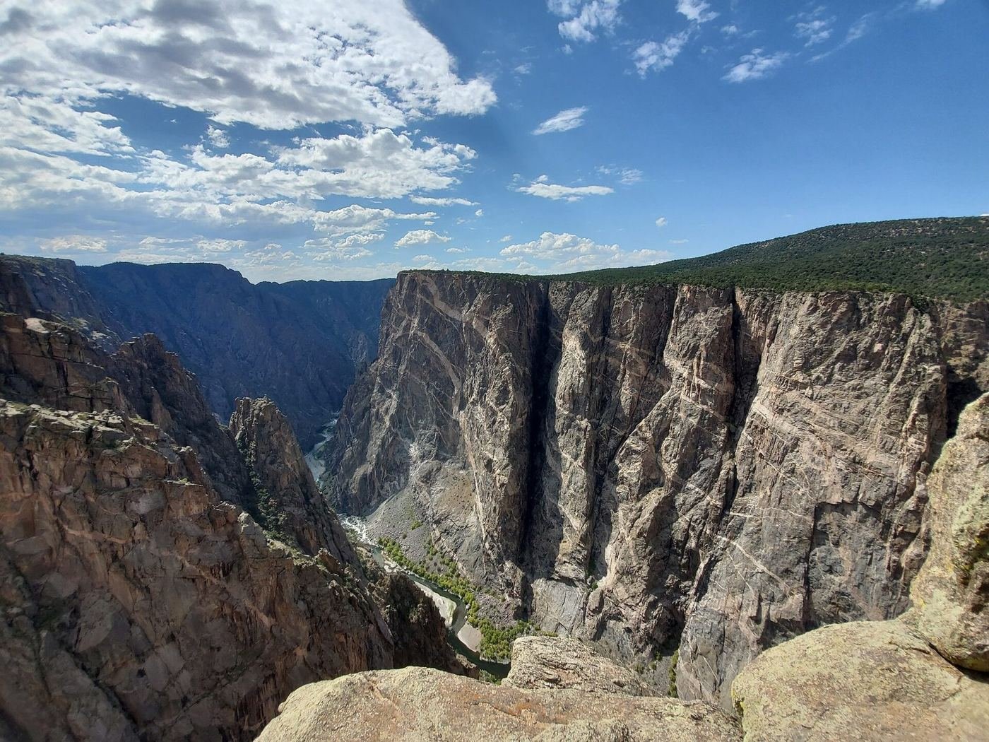
The Black Canyon of the Gunnison is one of the most dramatic gorges in the country, and it's the kind of place you feel more than see: a narrow, sheer-walled slot, up to 2,700 feet deep and in places only 40 feet wide at the river, so steep and shadowed that the sun reaches the bottom for only a short time each day. The name comes from the darkness.
It's also a very easy park to enjoy. The South Rim Road runs 7 miles along the rim with a dozen overlooks, and most are a few steps from the car. The park is really two parts, the South Rim, which has the visitor center and most of the overlooks, and the quieter, more remote North Rim, about two hours away by car.
If You Only Have 1 Day: The South Rim Road
If I only had one day, I'd drive the South Rim Road from the visitor center to the far end, stopping at the overlooks, with a couple of short walks along the way. It's the whole park in half a day.
Painted Wall View — the headline overlook
A short, paved walk to an overlook of the Painted Wall, the tallest cliff in Colorado at 2,250 feet, striped with bands of pale pegmatite. The light is best in the morning or late afternoon, and it's an easy stop with a very dramatic payoff.
Gunnison Point and the Visitor Center Overlooks — the first look
A short walk from the visitor center to the first overlook of the canyon, with a view straight down to the river. It's an easy, accessible stop to start with, and a good orientation.
Warner Point Nature Trail — the far end
A gentle walk at the end of the road through piñon and juniper to a point with views of the canyon, the Gunnison Valley, and the San Juan Mountains. It's the best sunset spot on the South Rim, and a quiet one.
Rim Rock Trail, a 1-mile out-and-back that links the visitor center with the campground, is a good morning stroll with views over the canyon.
Got a 2nd Day? Longer Walks on the South Rim
With a second day I'd take on the longer rim trails, which give you more of the landscape and a lot more quiet.
Oak Flat Loop Trail — the best loop
A loop that descends through an oak forest below the rim, with views up the canyon walls and a small ravine. It's one of the few trails that drops below the rim without needing a permit, and it's a good way to feel the depth.
Cedar Point Nature Trail — the quick view
A short walk to a point with views of the Painted Wall and Wildcat Point, with signs about the geology. A good, easy stop for the end of the day.
Uplands Trail — the easy forest walk
A gentle trail through piñon and juniper forest, away from the rim, with a chance of seeing deer and birds. A good, quiet alternative to the overlooks.
The Full 3 Days — The North Rim
With a third day I'd head to the North Rim, which is smaller, quieter, and much more remote. It's about a two-hour drive from the South Rim, but it's a different park.
North Vista Trail to Exclamation Point — the signature North Rim walk
A trail through forest and along the rim to Exclamation Point, a view straight down into the canyon with the Painted Wall visible on the opposite side. It's the best North Rim walk, and it's quiet.
Deadhorse Trail — the quiet rim walk
A trail along the rim through sagebrush and oak scrub, with sweeping views and almost no other people. A good option for a day of solitude.
North Vista Trail to Green Mountain — the big day
A longer climb to the top of a ridge with views into the canyon and across the valley. It's a good option if you want a real hike on the North Rim.
Where I'd Eat
There's no food in the park, so I'd plan meals in Montrose, 15 miles from the South Rim, or in Crawford for the North Rim, and bring a picnic.
Camp Robber
A well-liked Montrose restaurant with a creative menu and a casual setting, a good dinner after a day at the canyon.
View on Google Maps ↗Horsefly Brewing Company
A Montrose brewpub with a patio, local beer, and burgers.
View on Google Maps ↗Colorado Boy Pizzeria & Brewery
A Montrose spot for wood-fired pizza and house beer, a good casual dinner.
View on Google Maps ↗City Market (Montrose)
A full grocery store with a deli and bakery, the best place to pick up a picnic lunch and water.
View on Google Maps ↗Crawford cafés
The tiny town of Crawford, near the North Rim, has a handful of locally owned cafés. Hours are limited, so I'd call ahead.
View on Google Maps ↗Where I'd Stay
There's no lodging inside the park, so Montrose is the base for the South Rim, and Crawford for the North Rim.
Montrose, CO
The biggest nearby town with a range of chain and independent hotels, about 15 miles from the South Rim.
View on Google Maps ↗The Stone House Inn
A small inn in Crawford, about 30 minutes from the North Rim, with a quiet, rural feel.
View on Google Maps ↗South Rim Campground
The park's main campground, near the visitor center. It has been affected by the 2025 fire, so check its status and any reopening dates.
View on Google Maps ↗Build This Exact Trip, Free
I built ParkPlan because I wanted this kind of plan for every park, not just the one I happened to write up. It turns this into a real day-by-day itinerary with your own dates, travelers, and budget.
Start My Black Canyon Trip → Or see full park details first at parkplan.org/?park=black-canyonNearby Parks to Pair With Black Canyon of the Gunnison
Building a longer road trip? These guides sit within a day's drive of this one.
Road openings, fire-related closures, and permit rules change from year to year — always confirm current conditions, road status, and reservation rules at nps.gov/blca before you go.