
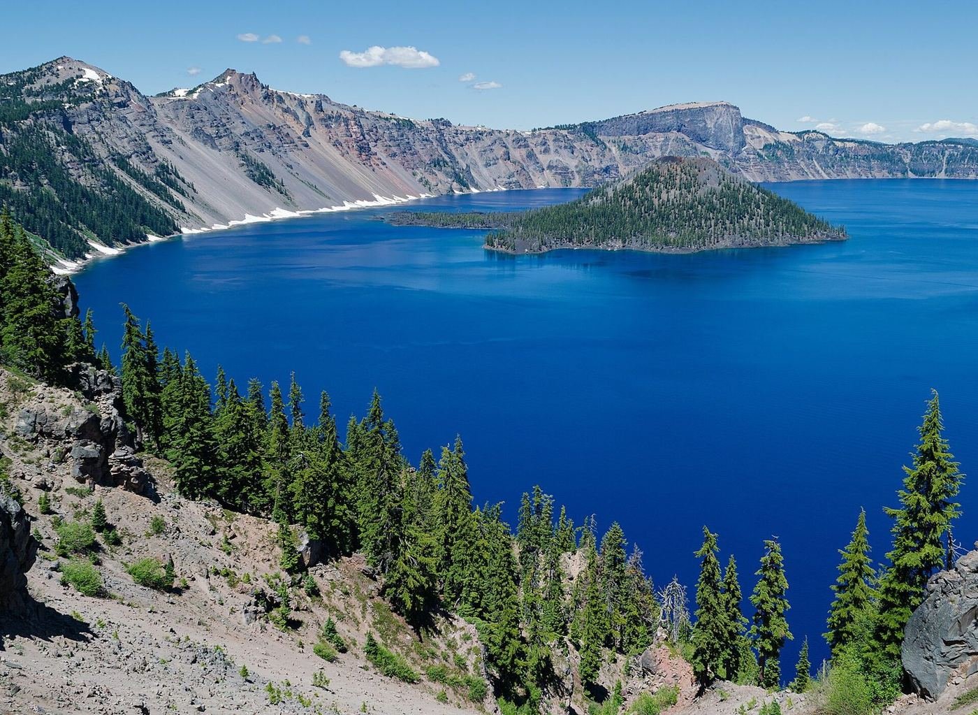
Crater Lake is the deepest lake in the United States, at 1,943 feet, and the color is the thing that doesn't translate to photos: a deep, almost electric blue that comes from the water's depth and clarity, with no rivers flowing in or out. It sits inside the collapsed remains of a volcano, Mount Mazama, which erupted about 7,700 years ago, and everything you do here is looking down at it from the rim.
That shapes the trip. The park is small and compact, but it's high — most facilities sit above 6,000 feet — and it gets some of the heaviest snowfall in the country, so the calendar matters more here than almost anywhere. I'd also check this year's construction closures, because a couple of the park's headline experiences are being rebuilt and the plan has to work around them.
If You Only Have 1 Day: Rim Village and the West Rim
If I only had one day, I'd base it around Rim Village, where the lodge, the café, and the first big views are within a few minutes of each other, then drive the open part of the rim and stop at the overlooks.
Discovery Point — the first look
A gentle walk along the rim from Rim Village to the point where the first miners spotted the lake in 1853. It's the easiest introduction to the scale, with views of Wizard Island and the opposite rim, and it works at any time of day.
Garfield Peak Trail — the best view for the effort
A steady climb from the lodge up a ridge to a summit at about 8,054 feet, with a look straight down on the lake and across to Mount Thielsen on a clear day. It's steep, but it's a well-built trail, and it's the one hike I'd do if I only had time for one. I'd go in the morning, before the afternoon haze.
Rim Drive overlooks — the drive
A scenic loop with about 30 pullouts, each a different angle on the lake. Even with part of the east side closed for construction, the open sections give you most of the views. I'd stop at Watchman Overlook and the Phantom Ship Overlook if the road reaches it.
The Rim Village Café is a quick, year-round stop for sandwiches and coffee, and the Sinnott Memorial Overlook next to it is a short, easy walk with exhibits on how the lake formed.
Got a 2nd Day? Mount Scott and the Quiet Trails
With a second day I'd go higher, and quieter. The summit views are better than the rim views, and the trails away from the lake are where the crowds disappear.
Mount Scott Trail — the highest point
The highest point in the park at 8,929 feet, reached by a long, steady climb to a fire lookout with a 360-degree view of the lake and the Cascades beyond it. It's the best sunrise spot in the park, and it's exposed, so I'd carry a warm layer and check the wind.
Watchman Peak Trail — the sunset hike
A short climb to a fire lookout directly above Wizard Island, and the best sunset view in the park. It's short enough to do at the end of the day, but the trail gets steep near the top.
Plaikni Falls Trail — the easy waterfall
A gentle, shady walk to a small waterfall that comes out of the canyon wall, through wildflower meadows in summer. It's one of the few trails away from the rim, and it's easy enough for kids.
The Full 3 Days — The Southern Trails and Bigger Hikes
With a third day I'd head to the south side, where the trails go through old-growth forest and canyons rather than to the lake.
Annie Creek Canyon Trail — the canyon loop
A loop that drops into a pumice canyon filled with wildflowers in July, from near Mazama Village. It's a good option for a morning when the rim is clouded in.
Union Peak Trail — the volcanic plug
A long walk through forest and meadows to the remnant core of an old volcano, with a final scramble to the top. It's the best longer hike away from the lake, and it's far less crowded.
Godfrey Glen Trail — the shaded stroll
A short, flat loop along a canyon rim near park headquarters, with views of volcanic spires. It's a good, easy stretch for a rest day.
Where I'd Eat
Dining is concentrated at Rim Village and Mazama Village inside the park, with a few good stops on the way in from Highway 62 and Highway 138. Many are seasonal.
Crater Lake Lodge Dining Room
The historic lodge's dining room, with views of the lake and a short, seasonal menu. I'd book a table ahead for dinner in July and August.
View on Google Maps ↗Annie Creek Restaurant
A seasonal, family-friendly restaurant at Mazama Village with sandwiches, soups, and pizza. A practical dinner stop after a hike.
View on Google Maps ↗Rim Village Café & Gifts
A year-round café at Rim Village with sandwiches, salads, and snacks. The easiest lunch near the rim.
View on Google Maps ↗Beckie's Cafe
A longtime stop at Union Creek on Highway 62 known for its pies and diner food, the classic pre- or post-park meal.
View on Google Maps ↗Mia & Pia's Pizzeria & Brewhouse
A well-liked Klamath Falls spot with pizza and a family-friendly dining room, handy if you're staying in town.
View on Google Maps ↗Where I'd Stay
Lodging inside the park is seasonal and limited, and the lodge books out many months ahead. Union Creek and Klamath Falls are the practical fallbacks.
Crater Lake Lodge
A historic lodge on the rim, open typically from mid-May to early October, with lake views from many rooms. It's the dream stay and the hardest reservation in the park.
View on Google Maps ↗Mazama Village Motor Inn
A simple, seasonal motel at the park's south entrance, about 7 miles from the rim. The easiest in-park room to book.
View on Google Maps ↗Union Creek Resort
A historic cabin resort on the Rogue River about 30 minutes from the south entrance, with a restaurant next door.
View on Google Maps ↗Build This Exact Trip, Free
I built ParkPlan because I wanted this kind of plan for every park, not just the one I happened to write up. It turns this into a real day-by-day itinerary with your own dates, travelers, and budget.
Start My Crater Lake Trip → Or see full park details first at parkplan.org/?park=crater-lakeNearby Parks to Pair With Crater Lake
Building a longer road trip? These guides sit within a day's drive of this one.
Construction closures, snow conditions, and seasonal facility dates change from year to year — always confirm current conditions, road status, and reservation rules at nps.gov/crla before you go.