
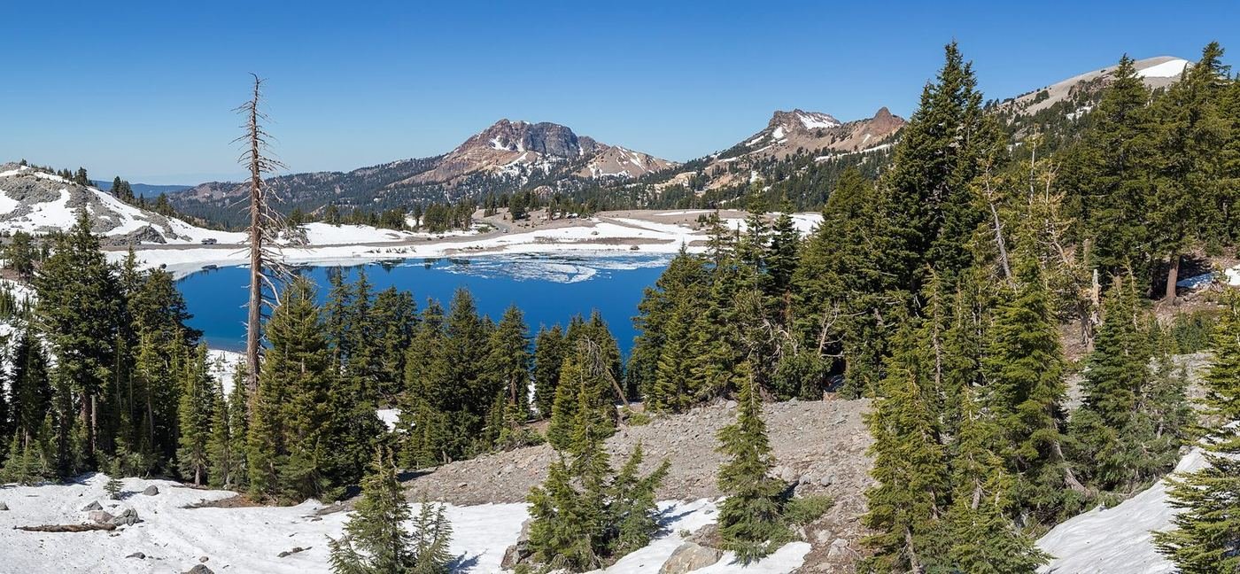
Lassen Volcanic is the park that has all four types of volcano — shield, composite, cinder cone, and plug dome — plus a basin of bubbling mud pots and steaming fumaroles, and it gets a fraction of the crowds of the parks around it. Lassen Peak itself last erupted in 1915, and the whole park still feels newly made.
The thing that shapes every trip here is snow. The park road tops out above 8,500 feet and is closed by winter storms for most of the year, usually opening in late May or June and closing again in October or November, and the high trails like Bumpass Hell often aren't clear until early July. I'd treat it as a July-to-September park, and I'd check the road status before I packed.
If You Only Have 1 Day: Bumpass Hell and the Park Road
If I only had one day, I'd drive the park road from end to end, with Bumpass Hell as the main stop. It's the park's best single hike and the best way to see what makes the place unusual.
Bumpass Hell Trail — the thermal basin
A well-built trail that descends through a lava-flow landscape to a boardwalk through the park's largest hydrothermal area, with roaring fumaroles, boiling mud pots, and aqua-colored pools. Stay on the boardwalk — the crust is thin and the water is scalding. It's the best hike in the park, and one of the best in California.
Lassen Peak Trail — the summit
A steady climb of about 2,000 feet up switchbacks to the 10,457-foot summit, with views across the Cascades to Mount Shasta on a clear day. It's exposed, and the altitude and snow can catch people off-guard, so I'd go early and bring layers.
Devastated Area Interpretive Trail — the short walk
A flat, paved loop through the area flattened by the 1915 eruption, with signs describing how the landscape recovers. It's the easiest way to understand the eruption, and it's a good stop on the way.
Sulphur Works, a roadside area of steaming vents right off the park road near the south entrance, is a quick stop that needs no walking.
Got a 2nd Day? Lakes, Waterfalls, and Quiet Trails
With a second day I'd go to the quieter side, where the lakes and waterfalls are. The trails here are shorter, shadier, and far less crowded.
Kings Creek Falls Trail — the waterfall
A trail that descends through forest and meadows beside a creek to a series of cascades in a narrow canyon. It's a pleasant, well-marked walk, and the return climb is the only hard part. A good, quiet alternative to Bumpass Hell.
Manzanita Lake Loop — the easy lake walk
A flat loop around a lake with a clear view of Lassen Peak reflected in the water on a calm morning. It's one of the most photogenic spots in the park, and an easy walk before breakfast.
Cold Boiling Lake Trail — the short lake walk
A short, gentle trail to a small lake that appears to boil but is actually just gas bubbling up through cold water. A quirky stop, and a good one for kids.
The Full 3 Days — Cinder Cone and the Backcountry
With a third day I'd head to the northeast corner, which is the most remote part of the park and has a landscape unlike the rest of it.
Cinder Cone Trail — the volcano you can climb
A steep climb up loose cinders to the rim of a perfectly formed cinder cone, with views across the Painted Dunes and a black lava field. The footing is loose and the climb is strenuous, but the view from the top is worth it.
Mill Creek Falls Trail — the big waterfall
A trail through the forest to the park's tallest waterfall, a thin cascade that drops 75 feet. It's a good, shaded hike on a warm day.
Terrace, Shadow, and Cliff Lakes — the lake chain
A quiet trail past a chain of small lakes in the forest east of the main road. A good choice if you want solitude.
Where I'd Eat
Dining inside the park is limited to a small café at the visitor center and a camper store at Manzanita Lake, so I'd plan meals in Chester or Mineral, and bring a picnic.
Kohm Yah-mah-nee Visitor Center Cafe
A small café at the park's south entrance with sandwiches and coffee, on reduced hours in the off-season.
View on Google Maps ↗Manzanita Lake Camper Store
A seasonal store at the north entrance with ready-to-eat meals and picnic supplies, usually open from mid-May to mid-October.
View on Google Maps ↗Kopper Kettle Cafe
A longtime Chester spot for breakfast, a straightforward start before the drive into the park.
View on Google Maps ↗Red Onion Grill
A Chester restaurant with an eclectic menu, a good dinner after a day on the trail.
View on Google Maps ↗Lassen Mineral Lodge
The nearest restaurant to the south entrance, in the town of Mineral, with simple lodge food.
View on Google Maps ↗Where I'd Stay
There's very little lodging in the park, so the practical bases are Chester and Mineral, or the cabins at Manzanita Lake.
Manzanita Lake Camping Cabins
Rustic cabins and a campground on the north side of the park, steps from the lake. Reservations fill early.
View on Google Maps ↗Drakesbad Guest Ranch
A remote, seasonal guest ranch in the southern part of the park with hot springs and a restaurant. A special place that books out well ahead.
View on Google Maps ↗Chester, CA
A small town with motels, restaurants, and a lake, about 45 minutes from the south entrance.
View on Google Maps ↗Build This Exact Trip, Free
I built ParkPlan because I wanted this kind of plan for every park, not just the one I happened to write up. It turns this into a real day-by-day itinerary with your own dates, travelers, and budget.
Start My Lassen Volcanic Trip → Or see full park details first at parkplan.org/?park=lassen-volcanicNearby Parks to Pair With Lassen Volcanic
Building a longer road trip? These guides sit within a day's drive of this one.
Road openings, snowpack, and seasonal facility dates change from year to year — always confirm current conditions, road status, and reservation rules at nps.gov/lavo before you go.