
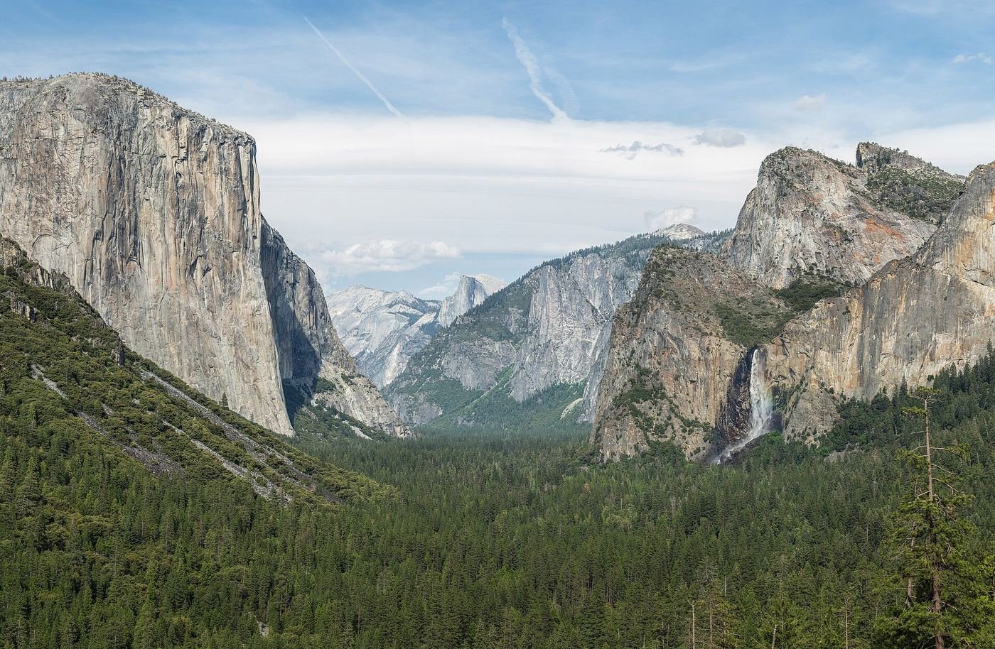
Yosemite is the park that made me rethink how much ground you actually need to cover to have a great trip. The valley itself is only about seven square miles, and I spent four days barely leaving it and still didn't run out of things worth doing. This is the guide I wish I'd had before I went: what to do with one day in the valley, what to add with two, and what the full four days look like once you start reaching up toward Glacier Point and Tuolumne Meadows.
If You Only Have 1 Day
One day in Yosemite means staying in the valley and picking a mix of an easy walk and one real climb, rather than trying to chase the whole park. I'd start at Tunnel View before the crowds, then work the valley floor.
Mist Trail to Vernal & Nevada Falls — the one hike I'd build the day around
This is the hike I'd tell a first-timer to do if they only do one. The trail climbs steadily along the Merced River, and once you cross the footbridge and keep going, the granite steps next to Vernal Fall get genuinely wet — you will get misted, sometimes soaked, depending on snowmelt that season. I brought a light rain shell just for this stretch and was glad I had it in late spring. Past Vernal Fall the trail keeps climbing to Nevada Fall, and that second push is where most of the crowd thins out. Trail conditions and partial closures near the top change with the season, so I checked current status at the visitor center the morning of rather than assuming last year's rules still applied.
Lower Yosemite Fall Trail — my easy add-on
A flat, paved loop right off the shuttle line to the base of Yosemite Falls, the tallest waterfall in North America. I did this one in the late afternoon after my legs were done with anything steeper, and it's still worth doing — the roar and spray at the base in peak snowmelt (April–June) is a different experience than the trickle you'll see by September.
If I had energy left after the Mist Trail, I'd drive up to Glacier Point for sunset rather than add another hike — it's a short walk from the parking area to one of the best views in the park.
Glacier Point — my go-to last stop
You drive most of the way up and then it's a short paved walk to the overlook, which puts you at eye level with Half Dome and looking straight down into the valley at Yosemite Falls and Vernal/Nevada Falls at once. Glacier Point Road is only open roughly late May through October or November depending on snow, so I'd confirm it's open before building a day around it. I got there about an hour before sunset and the light on Half Dome was worth the drive on its own.
Got a 2nd Day? Here's What I'd Add
With a second day, I'd use it for one of the park's bigger commitments — Half Dome if I'd planned far enough ahead to have a permit, or a longer but more accessible viewpoint hike if I hadn't.
Half Dome via John Muir Trail — if I have a permit
This is a full day, start-in-the-dark commitment, not a casual add-on. You need a permit to go past the base of the subdome, and those are only available through a lottery — a large preseason lottery held in March with results in April, plus a smaller daily lottery two days before each hike date. I applied in the March window and treated the daily lottery as my backup. The final push up the cables to the summit is the part that gets talked about most — steep granite with steel cables to hold onto — and it earns the reputation. I brought gloves specifically for the cables, and I'd tell anyone else to do the same; by midday the cable line backs up with hikers going both directions at once.
Sentinel Dome Trail — my pick if I don't have a Half Dome permit
A short, honest hike to a 360-degree summit view that rivals Glacier Point for a fraction of the effort — you can see Half Dome, Yosemite Valley, and on a clear day the high country beyond. It shares a trailhead area near Glacier Point Road, so I paired it with Taft Point the same afternoon since they're close together and both relatively short.
The Full 4 Days — How I'd Spend the Rest of the Time
By day three I'd already done the valley's headline hikes, so I used the extra time to get out of the valley entirely. If Tioga Road is open — it's typically cleared sometime between late May and mid-June and closes again around early November, so it's genuinely weather-dependent every year — I'd spend a full day up in Tuolumne Meadows. Lembert Dome and Dog Lake, or the longer haul out to Cathedral Lakes, feel like a completely different park up there: subalpine meadows and granite domes instead of a deep valley. On day four, if I still had gas in the tank, I'd drive south to Mariposa Grove and walk among the giant sequoias — it's a genuinely different ecosystem than anything in the valley, and worth the roughly hour-long drive from Yosemite Valley.
Where I Ate
I split my meals between the valley's in-park options and Mariposa, about 45 minutes from Yosemite Valley on Highway 140.
Pony Expresso Coffee House & Trading Post
My go-to before an early trailhead. A small coffee-shack-turned-cafe right on Highway 140 in Mariposa, open early enough for a pre-dawn Half Dome start.
View on Google Maps ↗June Bug Café
A casual, laid-back spot in nearby Midpines with vegetarian, vegan, and gluten-free options — I went here on a slower morning when I wanted a real sit-down breakfast.
View on Google Maps ↗Mountain Room Restaurant
Inside Yosemite Valley Lodge, with a wall of windows facing Yosemite Falls. I saved this for my last night in the valley — the view alone is worth the price.
View on Google Maps ↗1850 Restaurant & Brewery
A no-decision-fatigue night in downtown Mariposa — solid burgers and locally brewed beer after a big hiking day.
View on Google Maps ↗The Ahwahnee Dining Room
The grandest room in the park — soaring timber ceilings and floor-to-ceiling windows. I splurged here one night and made a reservation well in advance; it books up fast, especially for dinner.
View on Google Maps ↗The Elderberry House
In Oakhurst, a longer drive but a genuine fine-dining destination if you're based on the south side of the park near Highway 41 and want to treat yourselves.
View on Google Maps ↗Where I Stayed
The Ahwahnee
The park's iconic historic hotel, right in the valley. It's the splurge option, and rooms need to be booked well ahead, especially in summer — but waking up inside the valley walls is genuinely different from driving in every morning.
View on Google Maps ↗Mariposa or Oakhurst, CA
This is where I based myself for most of the trip — 30 to 75 minutes from the valley depending on the route, with far more lodging variety and lower prices than staying in-park.
View on Google Maps ↗Upper Pines Campground
In-park camping right on the valley floor, walkable to shuttle stops and trailheads. Reservations go fast — I'd book the moment the booking window opens if camping is the plan.
View on Google Maps ↗Build This Exact Trip, Free
I built ParkPlan because I wanted this kind of plan for every park, not just the one I happened to write up. It turns this into a real day-by-day itinerary with your own dates, travelers, and budget.
Start My Yosemite Trip → Or see full park details first at parkplan.org/?park=yosemiteNearby Parks to Pair With Yosemite
Building a longer road trip? These guides sit within a day's drive of this one.
Trail stats, permit rules, and pricing are accurate as of publication but change — always confirm current conditions, road status, and permit lottery dates at nps.gov/yose before you go.