
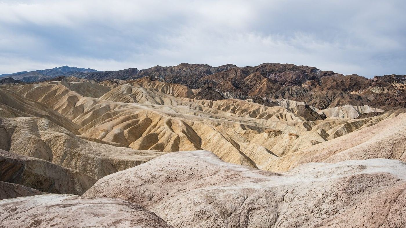
Death Valley is the largest national park in the lower 48, and the thing that surprises first-timers isn't the heat — it's the distances. Badwater Basin sits 282 feet below sea level, Dante's View looks down on it from more than a mile higher, and getting between the park's highlights can mean an hour in the car with nothing in between. A good Death Valley trip is mostly a scheduling problem: put the short, spectacular stops at the hours when the light and the temperature allow them.
That's how I'd build it. Sunrise and sunset do the heavy lifting, the middle of the day is for driving and shade, and every day is anchored to one of the park's two real hubs — Furnace Creek in the middle and Stovepipe Wells to the northwest. You can do the greatest hits in a single long day; two days lets you do them without rushing; three is when the quieter canyons and the high country start to make sense.
If You Only Have 1 Day: The Furnace Creek Core
If I only had one day, I'd stay within about 30 minutes of Furnace Creek and let the light do the work: Zabriskie Point at sunrise, a canyon walk while it's still cool, Badwater in the middle of the day when there's no shade anyway, and Artists Drive as the afternoon light turns. That sequence hits the four postcard views without a single long drive.
Zabriskie Point — start the day here
A short paved path climbs to an overlook above a maze of eroded, banded badlands in shades of tan, gold, and chocolate. It works best at sunrise, when the low light turns the folds three-dimensional and you'll have it nearly to yourself outside the busy season. It's the easiest high-reward stop in the park, and it's only a few minutes from Furnace Creek.
Golden Canyon to Red Cathedral — the morning hike
The trailhead is just off Badwater Road, and the canyon starts narrow and golden before opening up toward a wall of red-orange rock called the Red Cathedral. It's gentle underfoot and shaded early in the day by the canyon walls, which is exactly why I'd do it before the sun gets over the rim. If you want a longer loop, the Gower Gulch route turns it into a 4.3-mile circuit, but that adds exposure.
Badwater Basin — the lowest point in North America
The boardwalk and the first stretch of salt flat are all most people do, and that's fine — the polygon-shaped crust of salt a few hundred yards out is the real payoff. It's blindingly bright and fully exposed, so I'd go midday only in cooler months and bring sunglasses regardless. The sea-level sign on the cliff above the parking area is worth a glance before you walk out.
To finish the day, Artists Drive is a 9-mile one-way loop off Badwater Road that peaks at Artists Palette, where oxidized minerals paint the hillside in green, pink, and purple. The light is best in the last hour or two before sunset.
Got a 2nd Day? Shift to Stovepipe Wells and the Dunes
The second day moves about 25 miles northwest to Stovepipe Wells, which is where the park trades badlands for sand and narrow marble canyons. I'd flip the usual order here: dunes at sunrise or sunset, canyon in the middle of the day when its walls give some shade, and a long lunch break in air conditioning.
Mesquite Flat Sand Dunes — the dune walk
There's no marked trail — you simply walk out and climb whichever crest you like, and the tallest dune is roughly a mile from the parking area. Sand is soft going uphill and the heat radiates off it quickly after sunrise, so I'd treat this as a first-two-hours-of-light or last-hour-of-light stop. The texture of the ripples is the point, and the crowds thin out fast if you go 15 minutes past the first dunes.
Mosaic Canyon — marble walls and dry falls
A gravel road leads to the trailhead, and the first half mile is the highlight: polished marble walls, smooth enough to look wet, with a couple of short dry falls you can scramble up. The farther you go the more it opens into a wash, so plenty of visitors turn around at the narrows. It's the best shade you'll find in this part of the park by late morning.
Harmony Borax Works — the quick history stop
A paved, interpretive path loops past the ruins of the borax refinery that made the famous 20-mule-team wagons necessary. It's a flat, easy add near Furnace Creek that gives the park's mining story some context before you drive on toward the dunes or Dante's View.
If you have energy at the end of the day, the Devils Golf Course and Natural Bridge are both short stops off Badwater Road that I'd add on the way back to Furnace Creek.
The Full 3 Days — Dante's View and the Northern Park
With a third day I'd split it between the park's best view and its most dramatic crater. Dante's View is a 25-mile drive from Furnace Creek but it's the single easiest way to understand how deep the basin really is, and the cooler air up there is a relief in shoulder season.
Dante's View — the whole valley at once
The road climbs to about 5,475 feet, ending at a railed viewpoint looking straight down on Badwater Basin, with the Panamint Range across the valley. Sunrise and sunset are the best light, and it's often 20 degrees cooler than the valley floor. A short ridge walk from the parking area stretches the view out if you're not in a rush.
Ubehebe Crater Loop — the volcanic stop
A volcanic blast crater roughly 600 feet deep and half a mile across, reached by a long paved drive in the north end of the park. The rim loop is easy underfoot but breezy and exposed. I'd pair it with the drive up and out rather than making it its own trip, since it's the farthest stop from either hub.
Telescope Peak — only if you really want a summit
The park's high point at 11,043 feet is a serious, long day with thousands of feet of climbing, and snow and ice linger well into late spring. I'd only plan it in the cooler months with an early start and real layers — it's the opposite end of the park's character from the salt flats, and the view down to Badwater is the reward.
Where I'd Eat
Dining is concentrated at the park's resort hubs, and in the busy season (roughly October through April) the sit-down places fill up — I'd make reservations or plan on the casual option. These are the places I'd build meals around.
Forty-Niner Cafe
A straightforward all-day café at Furnace Creek Ranch — the easy pre-dawn breakfast or quick lunch near the central hub, and where I'd eat before heading out for sunrise.
View on Google Maps ↗The Last Kind Words Saloon
A western-style saloon at the Ranch with burgers and barbecue plates — the relaxed after-sunset dinner when you don't want to dress up.
View on Google Maps ↗The Inn Dining Room
The nicer meal in the park, set in the historic Inn at Death Valley. I'd save it for an evening after a long day outside, and book a table ahead in peak months.
View on Google Maps ↗Toll Road Restaurant
The main sit-down option at Stovepipe Wells Village, handy after a dune sunset. Menus are simple and portions are generous.
View on Google Maps ↗Panamint Springs Resort Restaurant
A rustic spot on the west side of the park — useful if you're coming in from Highway 190 via Lone Pine or heading toward Darwin Falls.
View on Google Maps ↗Mel's Diner
If you're sleeping in Beatty, Nevada, to save on lodging, this is the straightforward breakfast and dinner place — roughly 40 minutes from Furnace Creek.
View on Google Maps ↗Where I'd Stay
Lodging inside the park is limited and expensive in the cool season, so I'd book as early as I knew my dates. The in-park hubs are 30 to 60 minutes apart by car.
The Inn at Death Valley
The historic, spring-fed resort at Furnace Creek with a pool and views across the valley. It's the splurge, and the most atmospheric place to sleep in the park.
View on Google Maps ↗The Ranch at Death Valley
The more relaxed, family-friendly side of Furnace Creek, with a pool, a general store, and the best central location for a two-day trip.
View on Google Maps ↗Stovepipe Wells Village
A simple motel-style stay near the dunes — the best place to wake up for a sunrise dune walk without a drive.
View on Google Maps ↗Build This Exact Trip, Free
I built ParkPlan because I wanted this kind of plan for every park, not just the one I happened to write up. It turns this into a real day-by-day itinerary with your own dates, travelers, and budget.
Start My Death Valley Trip → Or see full park details first at parkplan.org/?park=death-valleyNearby Parks to Pair With Death Valley
Building a longer road trip? These guides sit within a day's drive of this one.
Road closures, flood damage, and heat advisories change fast in this park, and some stops mentioned here may be affected — always confirm current conditions, road status, and reservation rules at nps.gov/deva before you go.