
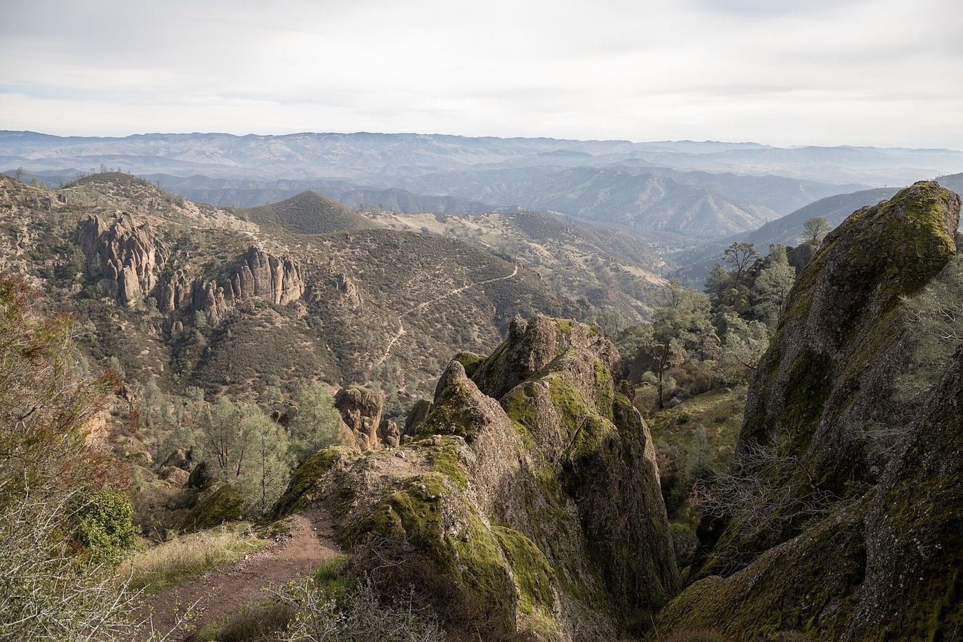
Pinnacles is a small park with a very big personality: a ridge of jagged volcanic spires and cliffs, the eroded half of an ancient volcano that's been carried 195 miles north from where it formed. It's also one of the best places in the country to see the endangered California condor, which nests in the cliffs and soars over the High Peaks.
The thing that surprises people is the layout. There's no road through the park. The east entrance, near Hollister, and the west entrance, near Soledad, are on opposite sides of the mountains, connected only by trails, so you pick one side for the day. The east is the more developed side, with a campground and the more popular Bear Gulch area; the west is quieter and has the Balconies Cave.
If You Only Have 1 Day: The High Peaks Loop
If I only had one day, I'd do the High Peaks, which is the park's signature hike and the best chance of seeing a condor. I'd start from the east side, with the Bear Gulch area, and leave time for a cave.
Condor Gulch to High Peaks Loop — the signature hike
A steep climb from the Bear Gulch area up to the rim of the High Peaks, then along a ridge with carved steps and railings through narrow, exposed sections. It's a thrilling walk with views of the spires and, with luck, a condor gliding at eye level. The footing is exposed in places, so it's not for anyone who's afraid of heights.
Moses Spring to Rim Trail Loop — the shorter option
A shorter loop from the Bear Gulch Nature Center that climbs through a narrow slot canyon, passes a small reservoir, and goes through Bear Gulch Cave on the way down. It's the best option if the High Peaks feels like too much, and it gives you a bit of everything.
Bear Gulch Cave — the talus cave
A short walk through a cave formed by huge boulders wedged in a narrow canyon, with a stream underfoot and steps in places. A flashlight is essential, and it's closed seasonally to protect a colony of bats, so check before you go.
The Prewett Point Trail, a short 0.9-mile out-and-back from the Bear Gulch parking area, is a quick way to get a view of the spires without a big climb.
Got a 2nd Day? The West Side and Balconies Cave
With a second day I'd drive around to the west entrance, which is quieter and has a very different feel — a flat canyon trail, a cave, and big cliffs to look up at.
Balconies Cliffs–Cave Loop — the west-side classic
A loop from the Chaparral parking area along a creek to the base of the Balconies, through a talus cave with a short, dark scramble, and back along the cliff base. It's the best west-side walk, and it's a good option for people who want a cave without the climb.
Old Pinnacles Trail to Balconies Cave — the longer walk
A flat, easy trail along an old road and a creek to the cave, with a good chance of seeing climbers on the cliffs. A good choice for a quiet half-day.
Juniper Canyon Loop — the steep climb
A strenuous loop that climbs from the west side up to the High Peaks via Juniper Canyon. It's the way to hike to the High Peaks from the west.
The Full 3 Days — The Backcountry and the Night Sky
With a third day I'd choose between a longer loop through the park's backcountry and a night-sky evening.
North Wilderness Trail Loop — the quiet loop
A long loop through the northern part of the park with very few people and big views, best done in the cooler months. It's the best choice for a full day of hiking away from the crowds.
Chalone Peak Trail — the summit
A climb to a peak with a long view of the Salinas Valley and the High Peaks. It's a good option for a clear day, but it can be hot and exposed.
Night sky at the Bear Gulch area — the evening
Pinnacles is a dark place, and the stars are remarkable on a clear night. Ranger programs run on some summer evenings, and the Bear Gulch area is a good place to set up.
Where I'd Eat
There's no food in the park beyond a small store at the east campground, so I'd bring a picnic and base meals in Hollister, Tres Pinos, or Soledad.
Cosmos Bar & Grill
A well-liked Hollister spot with burgers and sandwiches, a good dinner after a day on the trails.
View on Google Maps ↗Running Rooster
A casual Hollister place with wings, burgers, and tacos, easy and filling.
View on Google Maps ↗Veranda Cafe & Bakery
A café in Tres Pinos, on the way to the east entrance, with breakfast and sandwiches. A good pre-hike stop.
View on Google Maps ↗El Grullense Jal
A local favorite in Hollister for Mexican food, with large portions and a casual setting.
View on Google Maps ↗Pinnacles Campground Store
A small store at the east-side campground with snacks and basic supplies. A last-minute option, but not a meal.
View on Google Maps ↗Where I'd Stay
There's no lodging in the park other than the campground, so Hollister is the practical base for the east side, and Soledad for the west.
Pinnacles Campground
A large campground on the east side with a swimming pool in summer and a store. Reservations are smart in spring.
View on Google Maps ↗Hollister, CA
The nearest town to the east entrance, with a handful of hotels and restaurants about 35 minutes from the park.
View on Google Maps ↗Soledad, CA
A small town near the west entrance, with a few motels, about 20 minutes from the park.
View on Google Maps ↗Build This Exact Trip, Free
I built ParkPlan because I wanted this kind of plan for every park, not just the one I happened to write up. It turns this into a real day-by-day itinerary with your own dates, travelers, and budget.
Start My Pinnacles Trip → Or see full park details first at parkplan.org/?park=pinnaclesNearby Parks to Pair With Pinnacles
Building a longer road trip? These guides sit within a day's drive of this one.
Cave closures, trail closures for raptors, and fire danger change often — always confirm current conditions, road status, and reservation rules at nps.gov/pinn before you go.