
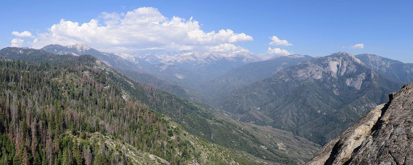
Sequoia and Kings Canyon are managed as one park, but they don't feel like one trip. Sequoia is the famous half: the General Sherman Tree, Moro Rock, and the Giant Forest, all on the Generals Highway at 6,000 to 7,000 feet. Kings Canyon is the quieter half to the north — Grant Grove, a long and beautiful drive down Highway 180, and Cedar Grove at the bottom of a glacier-carved canyon.
The mistake I'd tell anyone to avoid is trying to see both in a single long day without a plan. The roads are twisty, the speed limits are low, and what looks like a 30-mile hop on the map can take 90 minutes. Build around one hub per day and the trip gets a lot calmer.
If You Only Have 1 Day: The Giant Forest
If I only had one day, I'd spend it in the Giant Forest, because that's where the biggest trees on Earth are and where the park makes its best first impression. Start early — the General Sherman lot fills fast — and keep the pace slow enough to look up.
General Sherman Tree — the one everyone comes for
The largest tree on Earth by volume stands at the bottom of a paved trail from the main lot, and the walk is gentler going down than it is coming back up. The size doesn't fully register until you look at the people standing at its base. I'd arrive by 8 AM for parking, or use the park shuttle from the Giant Forest Museum in busy months.
Congress Trail — the loop through the biggest neighbors
From General Sherman, a paved loop continues past a cluster of named giants, including the President and the House and Senate groups, and it thins out the crowds quickly. This is the walk that makes the Giant Forest feel like a forest instead of a single tree. It's paved and gentle, which makes it the best choice with kids or older relatives.
Moro Rock — the staircase with the view
A staircase of around 350 steps climbs a granite dome to a summit with a sweeping view across the Great Western Divide. It's short, but it's steep and exposed, with railings, and I'd skip it in thunderstorms or heavy wind. The late afternoon light, when the haze thins out, is the best time.
On the way down, the Tunnel Log and the Crescent Meadow road are both quick stops if you have extra daylight — Crescent Meadow in particular is one of the quietest corners of the Giant Forest.
Got a 2nd Day? Drive North to Grant Grove
The second day shifts to Kings Canyon's Grant Grove, about 30 miles up the Generals Highway. It's smaller than the Giant Forest, but the trees are almost as large and the crowds are noticeably thinner, and it's a natural base for Cedar Grove if you want to push north.
General Grant Tree Trail — the nation's Christmas tree
A paved loop around the General Grant Tree, which is the second-largest tree in the world by volume and has been designated the nation's Christmas Tree. The loop also passes a fallen giant you can walk through and a cabin built from a fallen sequoia's wood. It's short enough to fit at the start or end of any day.
North Grove Loop — the quieter grove
A less-visited loop through a shady grove of giants, with a gentle grade and almost no crowds. It's my pick if you've already done the General Grant loop and want something more peaceful.
Panoramic Point — the view over the high Sierra
A narrow, winding road leads from Grant Grove Village to a paved path and a panoramic view across the Great Western Divide. It's a good, low-effort add for sunset on a clear evening.
The Full 3 Days — Down Into Cedar Grove
The third day is the one that makes Kings Canyon feel different from everywhere else in the Sierra. Highway 180 drops from Grant Grove down into a glacier-carved canyon along the Kings River, with a road that runs about 30 miles through some of the most dramatic scenery in either park.
Roaring River Falls — the easy waterfall
A short paved path leads to a viewing area where the Roaring River drops through a narrow granite chute. It's the quickest payoff on the Cedar Grove road, and the spray cools you off on warm afternoons.
Zumwalt Meadow Loop — the valley floor walk
A flat, scenic loop around a meadow beneath towering granite walls, partly on a boardwalk. I'd put this at the center of the Cedar Grove day — it's easy, gorgeous, and puts the canyon's scale in perspective.
Mist Falls Trail — only if you want a real hike
A longer, mostly shaded walk from Roads End up the Kings River to a powerful waterfall that's at its best in early summer snowmelt. It's the one real day hike in this part of the park, and the start of the climb is hot and exposed in the afternoon, so I'd go early.
Where I'd Eat
Dining inside the parks is limited and mostly concentrated at three clusters: Wuksachi and Lodgepole in Sequoia, and Grant Grove in Kings Canyon. Three Rivers, outside the Ash Mountain entrance, is where I'd eat if I were basing myself there.
The Peaks Restaurant at Wuksachi Lodge
The one full-service dining room in the Sequoia side of the park, open for breakfast, lunch, and dinner. I'd treat it as the dependable meal after a long Giant Forest day.
View on Google Maps ↗Lodgepole Market & Grill
A seasonal market and grill near the Giant Forest, usually open from mid-spring through fall. It's the easiest place to pick up trail food and sandwiches.
View on Google Maps ↗Grant Grove Restaurant
The main sit-down option in Kings Canyon, serving breakfast, lunch, and dinner in season. It's simple, filling, and well placed for a Grant Grove day.
View on Google Maps ↗Sierra Subs & Salads
A Three Rivers lunch stop that makes picnic food easy before you head up the mountain.
View on Google Maps ↗Gateway Restaurant & Lodge
A riverside spot near the Ash Mountain entrance with a deck over the Kaweah River — a good first-night dinner before the climb.
View on Google Maps ↗Cedar Grove Snack Bar
A seasonal stand at the base of the canyon, usually open from mid-to-late May into October. I'd bring a real lunch and treat this as a coffee-and-snack stop.
View on Google Maps ↗Where I'd Stay
In-park lodging is limited and books out early for summer, so I'd reserve as soon as I had dates. If I couldn't get in, Three Rivers and the Grant Grove cabins are the easiest fallbacks.
Wuksachi Lodge
The main hotel on the Sequoia side — about 20 minutes from the General Sherman Tree and the best base for the Giant Forest. It's modern, comfortable, and often sold out for peak summer weeks.
View on Google Maps ↗Grant Grove Cabins
A cluster of rustic cabins in Kings Canyon, ranging from tent-cabins to basic rooms with a bath. Best if you want to be near General Grant at dawn.
View on Google Maps ↗Three Rivers, CA
The widest range of motels and cabins, about 5 miles from the Ash Mountain entrance. It adds time to every day, but it's the practical choice when the park lodges are full.
View on Google Maps ↗Build This Exact Trip, Free
I built ParkPlan because I wanted this kind of plan for every park, not just the one I happened to write up. It turns this into a real day-by-day itinerary with your own dates, travelers, and budget.
Start My Sequoia & Kings Canyon Trip → Or see full park details first at parkplan.org/?park=sequoia-kings-canyonNearby Parks to Pair With Sequoia & Kings Canyon
Building a longer road trip? These guides sit within a day's drive of this one.
Road closures, cave tour ticket rules, and seasonal facility dates change from year to year — always confirm current conditions, road status, and reservation rules at nps.gov/seki before you go.