
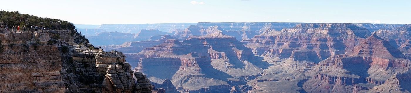
The Grand Canyon is the park that made me rethink what "hiking" even means. Everywhere else, the hard part of a trail is the climb up. Here, the elevation gain comes on the way back — you walk downhill into a furnace-hot inner canyon feeling great, and then you owe every one of those feet back before you're done, usually in rising heat. This is the guide I wish I'd had before I went: what to do with one day on the South Rim, what to add with two, and what the full three days actually look like hour by hour.
If You Only Have 1 Day
One day means picking how far below the rim you actually want to go, and I'd make that call before I laced up — the two main corridor trails both drop into the canyon fast, and the only real mistake here is going farther down than you can comfortably climb back up in the same afternoon heat.
South Kaibab Trail to Ooh Aah Point — my pick for the best view-per-mile in the park
South Kaibab follows an exposed ridgeline instead of a side canyon, which means the views start immediately and never let up — Ooh Aah Point earns its name honestly within the first mile. The tradeoff, and it's a real one, is that there is no water anywhere on this trail except a seasonal spigot near the trailhead — I carried more than I thought I'd need and was still glad to have it. There's also no shade. I parked at the South Kaibab trailhead lot when it had space, but more often took the free shuttle, since the lot fills early and isn't huge.
Bright Angel Trail to the 1.5-Mile Resthouse — if I want shade and water stops
Bright Angel is the more forgiving of the two corridor trails — it switchbacks through a couple of shaded side canyons and has seasonal water available at the resthouses during the warmer months, which South Kaibab simply doesn't offer. It's also the mule trail, so I got used to stepping aside and yielding the uphill side of the trail whenever a mule train came through. I treated the 1.5-Mile Resthouse as my turnaround for a one-day visit and didn't push further — the return climb is the part that gets people in trouble, not the way down.
Whichever trail I did in the morning, I saved the last hour of daylight for one specific spot.
Sunset at Hopi Point — my go-to last stop
Hopi Point juts out farther into the canyon than most South Rim overlooks, which gives it one of the widest unobstructed views anywhere on the rim — and it's the single most popular sunset spot in the park for exactly that reason. I took the free Hermit Road shuttle out (the road itself is closed to private cars for most of the year) and got there at least 45 minutes early to actually get a spot along the rail. It's genuinely crowded at peak season, but I've never regretted going anyway.
Got a 2nd Day? Here's What I'd Add
With a second day, I slowed down and let the rim itself do the work — no elevation loss required, just time and the shuttle system.
Rim Trail (South Rim) — the easiest big miles in the park
The Rim Trail runs mostly paved and mostly flat along the canyon edge, connecting a long string of overlooks, and the best part is you can walk any piece of it and catch the free shuttle back whenever you're done — there's no obligation to do it end to end. I walked the stretch between Grand Canyon Village and Hermits Rest in pieces over the day, hopping on and off the shuttle whenever my legs or the crowds asked me to.
Desert View Drive — the scenic drive I didn't want to skip
This drive runs along the eastern half of the South Rim from Grand Canyon Village out to the Desert View Watchtower, with several pull-off overlooks along the way that see a fraction of the crowds near the village. The Watchtower itself, designed by Mary Colter, is worth the climb for the view up and down the Colorado River from a different angle than anywhere else on the South Rim.
The Full 3 Days — How I'd Spend Every Hour
By day three I'd already done the two headline overlooks and a good stretch of the rim, so I used the extra day to go deeper into the canyon than a single day comfortably allows — this is where I'd point anyone who's in reasonable hiking shape and wants to actually feel the scale of the place, not just look at it.
Bright Angel Trail to Havasupai Gardens — the deeper push
Havasupai Gardens (the renamed Indian Garden) is a genuinely green, spring-fed oasis nearly halfway down to the river, and reaching it on Bright Angel gives you a real sense of the canyon's layered geology up close instead of from the rim. This is a full-day undertaking with serious elevation to reclimb in the same trip — I started at first light specifically to be back above the steepest switchbacks before the afternoon heat peaked, and I would not attempt this one in summer without a very early start and a real plan for water.
Where I Ate
I split my meals between Grand Canyon Village, right on the South Rim, and Tusayan, the gateway town about ten minutes south of the entrance.
Bright Angel Fountain
An old-fashioned, seasonal ice-cream and soda counter right on the rim near the Bright Angel trailhead — no indoor seating, just the canyon wall to lean against while you eat. My go-to for a quick bite before or after a rim hike.
View on Google Maps ↗Bright Angel Restaurant
Casual, all-day dining inside the historic Bright Angel Lodge — my pick for breakfast before an early trailhead start, since it opens before most other village options.
View on Google Maps ↗Maswik Food Court
The fastest, most affordable option in the village — a cafeteria-style food court that's an easy, no-reservation lunch between a morning hike and an afternoon drive.
View on Google Maps ↗Arizona Steakhouse
Arguably the best canyon views of any sit-down restaurant on the South Rim, especially at a sunset table. Reservations are worth making ahead in peak season.
View on Google Maps ↗El Tovar Dining Room
I saved this for my last night — a historic 1905 lodge dining room with genuinely elevated food for a national park. Reservations open six months ahead for hotel guests and 30 days ahead for everyone else, and they go fast.
View on Google Maps ↗We Cook Pizza and Pasta
A Tusayan institution since 1981 and a genuine local favorite, not just a tourist stop. An easy, low-key dinner in town when I didn't want to deal with village crowds or reservations.
View on Google Maps ↗Where I Stayed
Tusayan or Williams, AZ
Tusayan sits about ten minutes from the South Rim entrance and is the easiest base if you want to be first through the gate. Williams is closer to an hour out but tends to run cheaper and has its own small-town charm.
View on Google Maps ↗El Tovar / Bright Angel Lodge
The historic in-park lodges sit right on the rim itself — El Tovar is the grand, higher-end option, Bright Angel Lodge the more affordable historic pick next door. Both book out 6 to 13 months ahead, so this is the first reservation I'd make, not the last.
View on Google Maps ↗Mather Campground
In-park and reservable, an easy walk or short shuttle ride from Grand Canyon Village if you're comfortable camping instead of booking a room a year out.
View on Google Maps ↗Build This Exact Trip, Free
I built ParkPlan because I wanted this kind of plan for every park, not just the one I happened to write up. It turns this into a real day-by-day itinerary with your own dates, travelers, and budget.
Start My Grand Canyon Trip → Or see full park details first at parkplan.org/?park=grand-canyonNearby Parks to Pair With Grand Canyon
Building a longer road trip? These guides sit within a day's drive of this one.
Trail stats, water availability, and pricing are accurate as of publication but change — always confirm current conditions at nps.gov/grca before you go.